
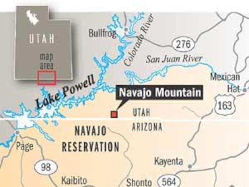
In remote southeastern Utah — where dirt roads, wrinkled landscape and open air rule — located somewhere between Forbidding Canyon and No Man Mesa is the state's most mysterious mountain.
Many likely don't know its name, and others are unaware that most of the mountain lies in Utah. A mammoth mound of rock and sand as big as Mount Nebo, Navajo Mountain is a high-elevation (10,388 feet above sea level), rounded dome resembling a whale's back. It's also the area's most prominent landmark, rising almost 7,000 feet above Lake Powell in the Navajo Indian Reservation.
Navajo Mountain is so remote that's it's off the "radar screen" for most hikers and outdoor lovers.
Leo Manheimer, chapter president of the Navajo Mountain Chapter House that sits on the southeast side of the mountain, said it is one of four sacred mountains in the region.
"It's the highest point in the Navajo Nation boundaries," he said.
Sacred to most Navajos — including some who believe it shouldn't be climbed — this mountain in San Juan County is less than 3 miles from Rainbow Bridge, another sacred Indian site. For more than a 50-mile radius, this mountain is the dominant natural feature. Even boaters on Lake Powell will find that when Navajo Mountain is in sight, cellular telephones usually work. That's because transmitters on the summit serve the entire region.
According to "Navajo Places: History, Legend and Landscape," by Laurane D. Linford, in Navajo the mountain is "Naatsis'.00n" — Head of the Earth. It refers to the head of the sacred female and pollen range of Navajo belief.
Indeed, some traditional Navajos believe that other geological features scattered over the region represent some of her other body parts. Black Mesa is her body, the Balakai Mesa her feet, Comb Ridge an arm, and another ridge the other arm. Agathia Peak and Tuba Butte are her breasts.
Navajo Mountain also figures into several other tales, and "Place of Rising" and "Flint Hogan" are individual sacred places atop its summits.
A laccolithic dome (an irregular formation of igneous rock), Navajo Mountain has a volcanic origin, though laymen would never think so by looking at it. Some of the only volcanic rock visible is on the mountaintop's north end.
Spanish troops visited the area in 1583 and named it "Sierra Panoche," meaning "Corn Mountain." The region was also known as a Navajo stronghold in those early days.
Explorer John Wesley Powell named it "Mount Seneca Howland," after a member of his 1869 Colorado expedition who was killed by unknown assailants. However, the name Navajo Mountain was coined by Almon Thompson, Powell's brother-in-law and assistant, in the early 1870s.
Some history books have suggested that Navajo Mountain was used as a heliograph station during the Navajo wars of 1863-64, but critics are quick to point out that this technology, using signal mirrors, was unknown then. A helio station was established there in 1884, however.
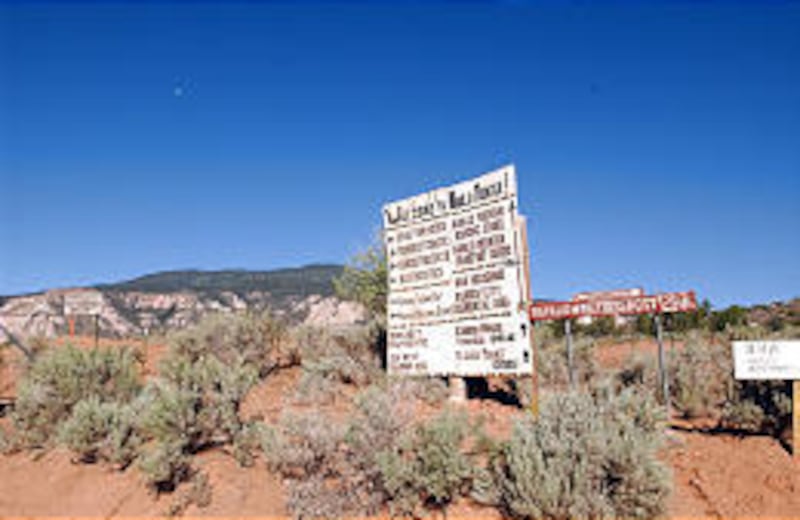
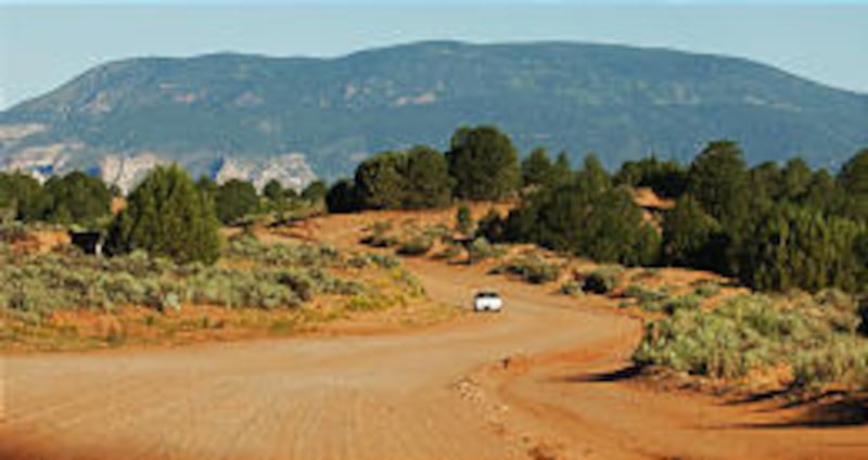
A wagon road to the base of Navajo Mountain was not completed until 1925. The road was rebuilt by the Civilian Conservation Corps in the 1930s. Sections of the road were paved starting in 1988. Even today, access to the Navajo Chapter Community (elevation, 6,050 feet) of about 500 persons is only accessible by almost 20 miles of dirt road. Some roads in the interior of the community are paved.
Linford reports that traditional Navajos are reluctant to climb the peak and may fear underground rumblings on its west slope. It wasn't until the 1940s that Navajos would go north of the mountain into what is now the canyon country of Lake Powell. However, Piute Indians would always travel the region with no hesitation.
Rumors of silver being discovered on the mountain in the 1880s have never been verified.
Manheimer said climbing the mountain doesn't hold the same strict taboo today as in the past. Part of the reason for that may be the presence in recent years of the transmission and microwave towers on Navajo's summit.
(However, the Internet site www.navajonationparks.org/, the Navajo Nation Web site, still states the traditional belief: "Navajos consider Navajo Mountain as a sacred area, and ascending it is forbidden.")
Manheimer said various Navajos have recently quit using the mountain top for religious ceremonies and now conduct them at the base area.
Navajo Mountain also contains the only limber pines in the entire Navajo nation.
The Navajo Mountain community itself probably also qualifies as the most isolated in all of Utah. Cars in the area all have Arizona license plates, an Arizona post office sits some 10 miles inside Utah's borders, and all the telephones have Arizona area codes. To access the area from Utah you have to go through Page or Monument Valley deep into Arizona and then back into Utah.
Like Grouse Creek, in Utah's northwest corner, a long section of dirt road is the only way to reach this isolated island of a community by land.
"Don't expect any views from the (actual) summit, as it is all wooded in, but if you walk to the north . . . then the panorama really opens up and Rainbow Bridge is in view," Bob Greenawalt, Rosemead, Calif., who went to the top of Navajo Mountain a few years ago, said. "That's worth the whole trip."
Barry Goldwater, the late Arizona senator, once referred to Navajo Mountain as a "rocky buttress." He once owned a trading post in that area.
— For more information on Navajo Mountain, go online to utah.com/navajomountainhistory.shtml.
E-MAIL: lynn@desnews.com