
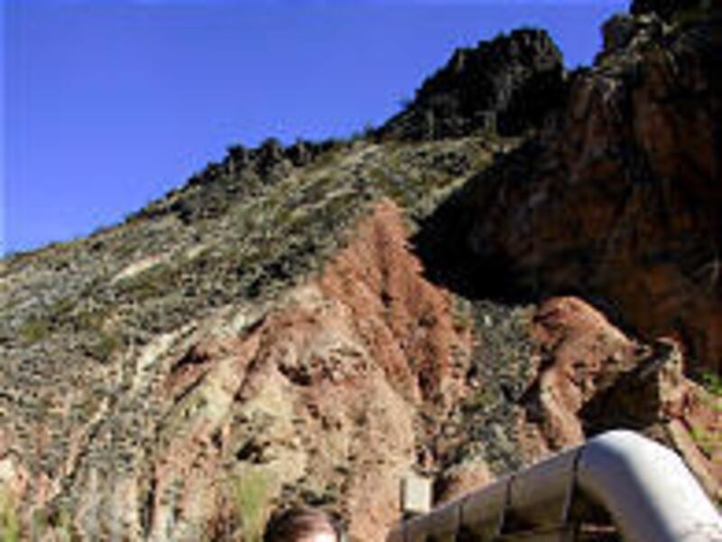
HURRICANE, Washington County — A study on the Hurricane Fault in eastern Washington County will help cities and developers evaluate the seismic risk of building within the fault's boundaries, according to a senior scientist with the Utah Geological Survey.
"By anybody's definition, this is an active fault," said William Lund, a senior scientist with the UGS in its Cedar City field office and one of several geologists who worked on the Hurricane Fault study. "We have a pretty good idea of how big the last earthquake was, and a rough sense of when the last one was, but what we really don't know is how often quakes occur (on the Hurricane Fault)."
Lund is editor of the the Paleoseismology of Utah Series, which recently published the study through the Utah Geological Survey.
Building codes, hillside development and sensitive land ordinances passed by various cities in Washington County address developments in geologically hazardous locations, but predicting future problems is still a shaky business.
"Enforcement of code is a critical element, but the real challenge is trying to develop proper and reasonable mitigation steps to prevent problems in the first place," said Bob Nicholson, community-development director for St. George. "We have a Hillside Review Board that scrutinizes requests from developers, but we still spend a lot of time trying to prevent problems."
St. George city approved close to 2,000 building permits for dwelling units in 2005 and about half that last year, he said.
"As the price of real estate goes up, the demand to push the envelope goes up at the same time," Nicholson said. "Homes start to climb up the hillsides and build on flood plains."
La Verkin city manager Ben Reeves said developers planning to build near the Hurricane Fault, which runs along the east side of town, are required to provide a geotechnical report.
"There is a tremendous pressure on us with growth on the hillside," he said. "We have a fairly restrictive building ordinance, but the challenge is to balance property rights with the greater good of the community. We're getting a lot of complaints about homes going up on the hill."
La Verkin issued 111 building permits in 2005 and only 37 in 2006. This year, the city has already approved 25 permits, with a large development under way near the city's water tank on the east hill.
Other cities in the county also require geotechnical reports or other specialized studies for developments in geologically sensitive zones.
Keeping the possibility of an earthquake on a city's radar screen isn't that easy, said Lund. A copy of the study was sent to each mayor, county commissioner and city engineer in Iron and Washington counties, he said.
"Quantifying the hazard is difficult here because we don't know how long it's been since the last big one," he said. "In a sense, it's kind of like geologic Russian roulette."
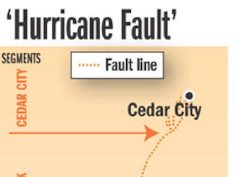
The Hurricane Fault study provides new information about the fault, which geologists say is broken up into at least three and possibly four segments along its 200-mile length from Cedar City through La Verkin, Hurricane and on across the Arizona state line. Each segment of the fault tends to rupture on its own timetable, Lund said.
"These segments break the fault up so you don't have huge earthquakes, but it's still possible to have quakes that are plenty big," he said.
The Cedar City segment of the fault is capable of producing a magnitude 6.6 earthquake, while a segment closer to La Verkin could produce an earthquake in excess of magnitude 7, according to the study.
"By far and away the greatest amount of damage (from quakes) is due to ground shaking, not surface rupture," Lund said. "St. George is closer to damages from an earthquake than Hurricane is, because of the serious ground-shaking hazards."
Fourteen years ago, residents of Washington County were jolted awake at 4:26 a.m. by a 5.8-magnitude earthquake that triggered several landslides in and around Zion National Park. Three homes were destroyed, state Route 9 was blocked, and utilities were disrupted for a time, but little damage was caused elsewhere.
Even so, said Lund, the 1992 quake was not considered to be a large earthquake and doesn't help geologists date when the last big quake occurred.
"When you are dealing with a hazard that is infrequent but potentially catastrophic, then it's important to listen to geotechnical opinions," he said.
"The geologic principles of the past help predict the future, so we try to design for the most probable event in a given time. It's a very educated gamble."
E-mail: nperkins@desnews.com