

Plodding through hundreds of pages of history books can be tedious and slow. Also, in this fast-moving world, people want instant facts and trivia.
In line with brevity and summarizing, here's a look at some highlights of Davis County history, listed in an easy and quick-read format:
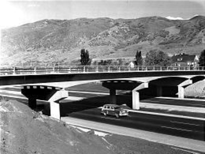
The final section of I-15 in Davis County, from Layton to Lagoon, was not completed until 1978 at a cost of $9.9 million.
A four-lane Highway 89, between Weber County and Farmington, opened in 1960, way ahead of its time for high traffic volume.
Farmington was originally called North Cottonwood. It was renamed Farmington in 1852.
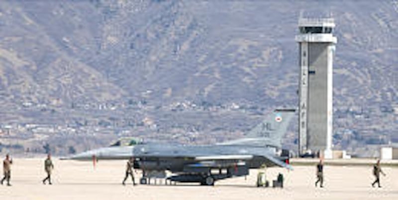
Although Hill Air Force Base is situated on a hill, the base was named for Maj. Ployer P. Hill, a test pilot who was killed in a crash of the prototype B-17 at Wright Field, Ohio, in 1935. Hill AFB was established in 1940.
Hill AFB's longest runway is 13,500 feet long.
Layton originated as an outgrowth of Kaysville. In fact, Layton residents were upset over taxation by Kaysville without any benefits. Lawsuits to the Utah Supreme Court and the U.S. Supreme Court were concluded in 1902 when Layton finally became an unincorporated area.
Clearfield was originally known as Sandridge. Its name was later changed to Clearfield because of its open spaces.
The first pioneer settlement in Davis County was believed to be near present-day 300 North and 200 West in Bountiful when Perrigrine Sessions and others set up their camp near Burton Creek in September of 1848.
By early 1851, there were 1,134 residents at 215 locations in Davis County.
Bountiful was originally called Sessions, North Canyon and even Stoker in the early 1850s. The area's LDS members eventually ended the name confusion and suggested a Book of Mormon name, Bountiful, as a title. The name became official in February of 1855.
Utah's first county courthouse was in Farmington. The adobe multipurpose building was completed in 1855 and torn down in 1890.
Salt Lake wasn't the only area to be plagued by crickets. Davis County had infestations in 1848 and 1849. "The crickets came like the locusts in the days of Moses," Bountiful area settler Perrigrine Sessions said. As in Salt Lake, seagulls ate many of the crickets.
A long drought meant water was scarce in the summer of 1855. Davis County families lived on roots and weeds to get by, as many harvests failed.
In Davis County's early days, livestock roamed free and were not fenced. Settlers actually fenced crops and often times did so in large sections of cooperative farms.
One reason that Farmington became the Davis County seat is the distance between Salt Lake and Ogden. Farmington was the best overnight stopover. There were three hotels there during the 1850s.
During the early railroad days in Utah, LDS bishops did more than lead their wards. They were also active in recruiting workers to help with railroad construction in Davis County.
In March 1870, one man rode the train from Ogden to Woods Cross in 95 minutes. This Utah Central Railroad cost $1.25 million but gave Davis residents easy access to transportation.
The 1880 Census revealed that 21.8 percent of the Mormon population in Davis County resided in polygamous families. The 1,140 men, women and children are believed to actually be fewer than the state average at the time for polygamous families.
Davis County began as a prime ranching area, just north of Salt Lake. However, by the 1880s, Davis County was billed as "The Garden Spot of Utah." A county float in 1897 in Salt Lake's July 24th parade highlighted the county's fruits and vegetables.
Mining never took off in Davis County. The closest it came was on Antelope Island in the 1880s when miners found copper and hoped to find a new Bingham Canyon, but all the veins there quickly played out.
Flooding has been a periodic disaster in Davis County. In August of 1912, floods in Bair Canyon after a rainstorm piled mud and debris 10 feet deep and 300 feet wide at the mouth of the canyon. August of 1923 was much worse. Drainage after a rainstorm in Farmington Canyon killed four Boy Scouts and a honeymooning couple there. Floods later in the summer of 1930 put 200-ton boulders at the mouth of Parrish Creek in Centerville.
At one time a road out of Hooper, Clinton and Sunset (today's 1800 North) traveled directly to the mouth of Weber Canyon. The creation of Hill Air Force Base in 1940 deleted the east half of that road.
Sources: "A History of Davis County," by Glen M. Leonard, and "The Utah History Encyclopedia," edited by Kent Powell.
E-mail: lynn@desnews.com