
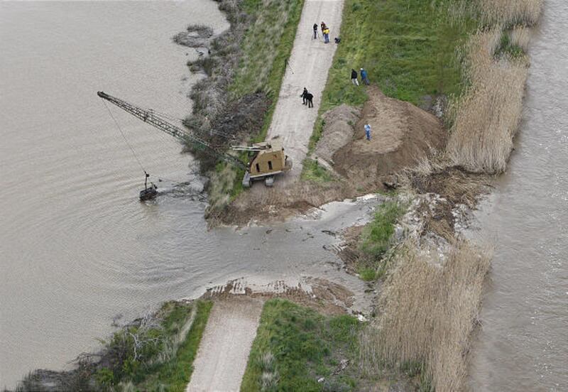

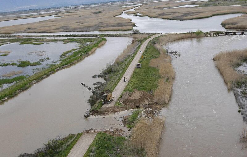
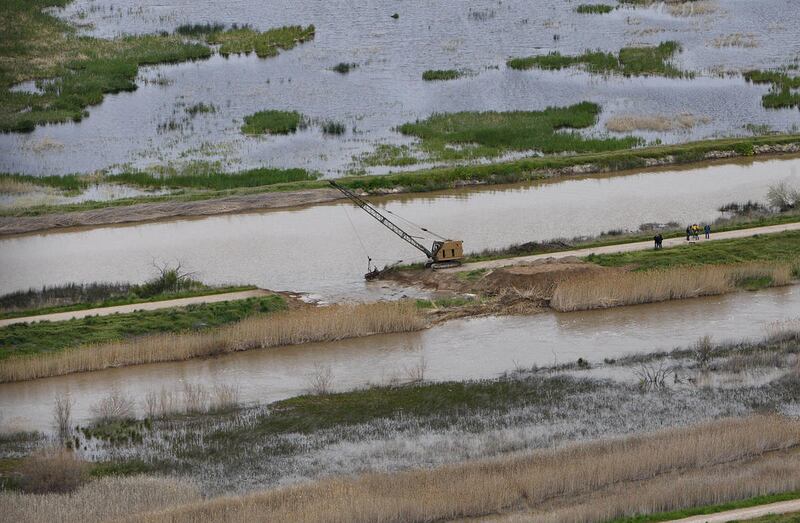
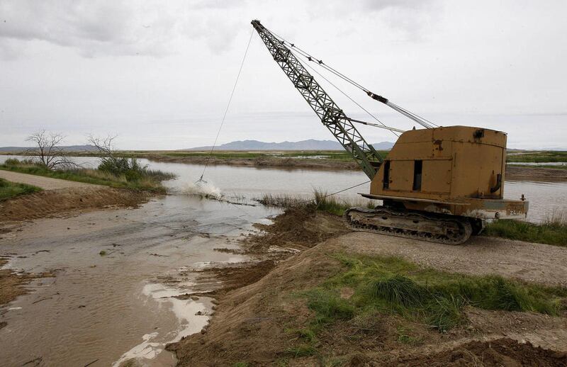

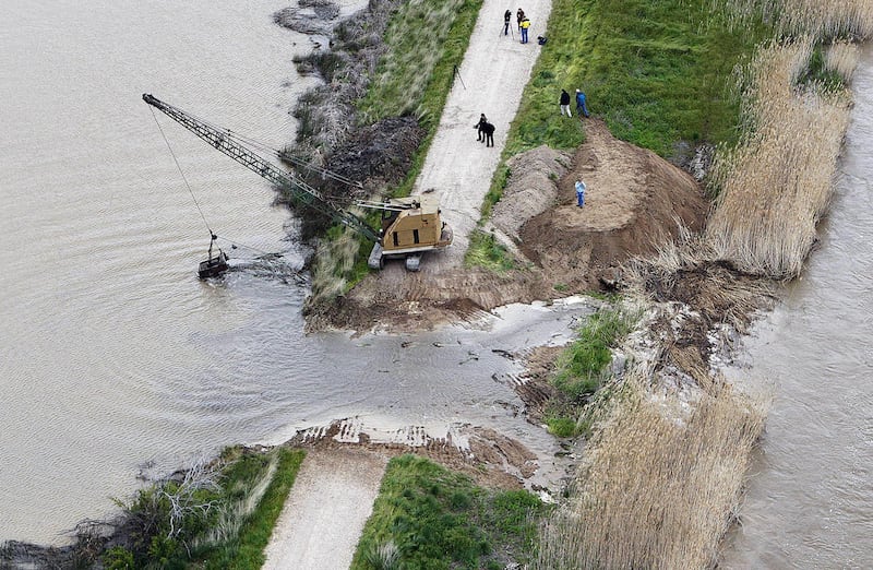
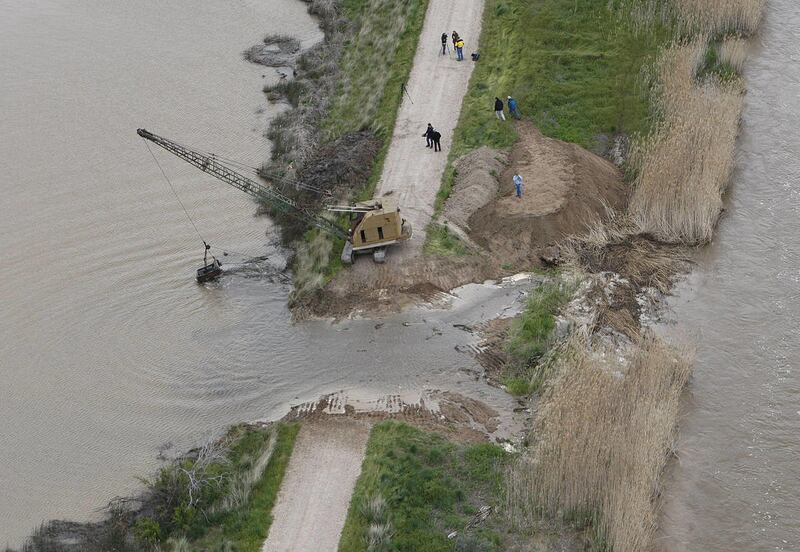
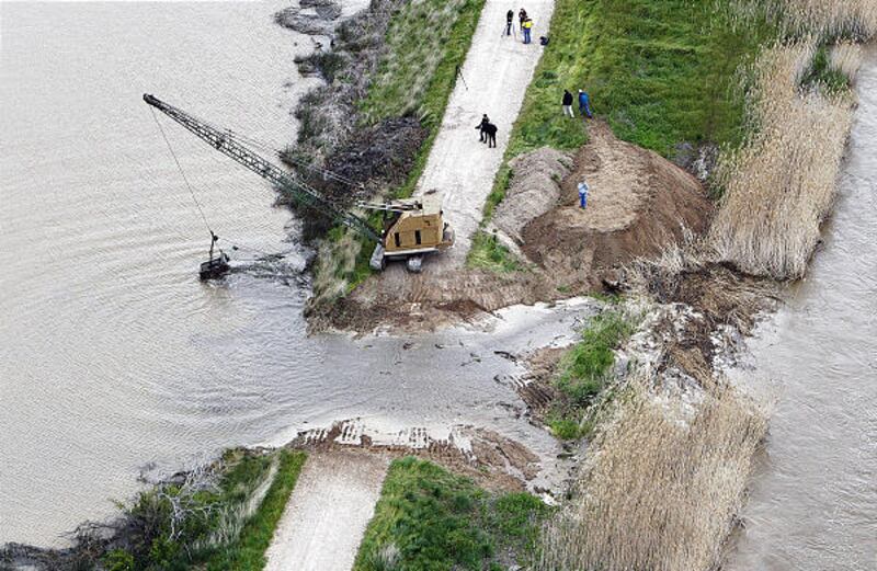
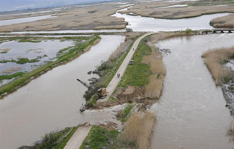

HOOPER — Two holes were punched in a levee here on Thursday and a third is under consideration as officials work to prevent further flooding in farming communities.
Phil Douglass, northern Utah's conservation outreach manager for the state Division of Wildlife Resources, said the necessity of a third breach will be evaluated based on the nature of the spring runoff in the weeks to come.
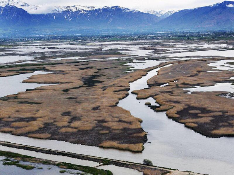
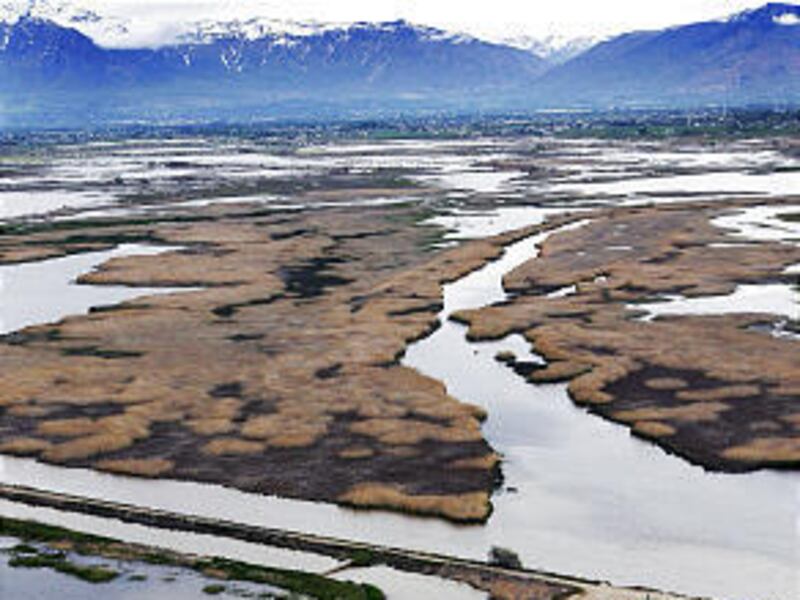
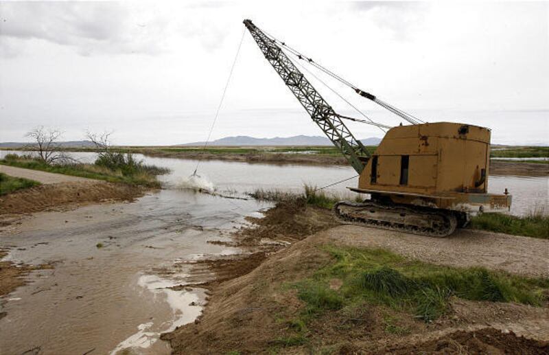
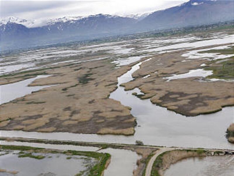
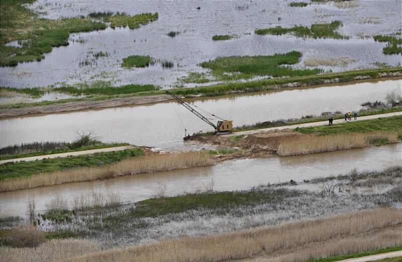
The breaches were made in a levee at the lower Weber River at the Ogden Bay Waterfowl Management area to move the water more quickly to the Great Salt Lake.
"Our hope is to increase the volume and speed of the water. If we move the water more quickly through the system, it will scour out some of the sediment load in the river as well as the sandbars," Douglass said.
The river is not flooding in this area because it is at the bottom of the system, he said.
The capacity is about 5,000 cubic feet per second and the river is flowing at 4,500 cubic feet per second, causing flooding.
"The prediction is there will be more water as the runoff continues to increase," Douglass said. "We are hoping this will be a pre-emptive strike."
The latest briefing from the National Weather Service contains dire predictions for Weber and Morgan counties, where two reservoirs are facing an overwhelming flow of water from the spring runoff. A third, small reservoir, Lost Creek is predicted to go over its spillway and Causey Reservoir is already spilling.
At Pineview in Ogden Valley, the reservoir has just 17 percent of its capacity left, but is expected to have to handle six times that volume of water from the runoff. The situation is worse at Morgan County's Echo Reservoir, which has 33 percent of its space left but is expecting nine times that volume of water.
It is a set of circumstances that has the staff of the Weber Basin Water Conservancy District up late at night and losing sleep, said general manager Tage Flint.
"We're talking about it day in and day out," Flint said. "We acknowledge this is an unprecedented snowpack for this time of year. We are wondering how much our infrastructure can mitigate here with the flooding."
Flint said reservoirs such as Pineview and Echo were not constructed to be flood control dams, but rather were designed as structures for drought relief and storage of water.
"The goal now is to not fill our reservoirs until after the peak runoff. We won't be able to accomplish that in all cases. We have to pass such a high volume of water it is going to be a real juggling act to release enough so we have enough space when real peak hits."
Lost Creek, which is predicted to spill in the next few days, is a small 20,000 acre feet reservoir that is simply overwhelmed by the runoff that has happened so far.
Flint stressed that the spilling of water at reservoirs does not mean the physical integrity of the dam is impaired in any way.
"There's been some confusion about that."
With it predicted to remain cold through Monday and more rain expected, Flint and other water managers are in an untenable situation.
"What scares us about Pineview, Echo and Wanship is that the upper elevation snow has just barely begun to melt and we know that the peak runoff is not going to hit until well into June."
The reservoir levels were successfully dropped at one point, but this month — which so far is the fourth wettest May in Utah that the weather service has documented — has compounded the problem of runoff.
"It is the rain that has killed us the last couple of weeks," Flint said. "We had a lot of storage available, but we have had to capture those high rain events and it is taking up our space."
Brian McInerney, hydrologist with the National Weather Service, said with summer-like temperatures finally expected to hit next week, downstream areas along the Weber and Ogden rivers and East Canyon and Lost creeks are forecast to flood at "significant" levels.
Elsewhere at troublesome spots, the latest information on river flows show:
• Green River near Jensen, at 98 percent of flood stage, but predicted to reach 100 percent within two days.
• South Fork, Ogden River near Huntsville, at 107 percent of flood stage and predicted to maintain at 107 percent for the next two days.
• Weber River near Gateway, in Weber Canyon, at 99 percent of flood stage but predicted to maintain at 99 percent for the next two days.
• Lost Creek above Croydon, Morgan County, at 99 percent of flood stage but predicted to reach 100 percent within the next two days.
• Blacksmith Fork River, near Hyrum, Cache County, at 96 percent of flood stage but predicted to maintain at 96 for the next two days.
• Little Bear River, near Paradise, Cache County, at 91 percent of flood stage and predicted to reach 94 percent within two days.
• City Creek, Salt Lake County, at 94 percent of flood stage.
On Thursday afternoon, the Cottonwood Heights Police Department was reporting some minor flooding at 9000 S. Little Cottonwood Road, where rushing water created a small ravine and sent a street sign tumbling down Little Cottonwood Creek.
E-mail: amyjoi@desnews.com
Twitter: amyjoi16