
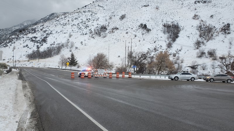

Avalanches have closed many of Utah’s canyon areas, leading to unsafe conditions fueled by strong, gusting winds.
The potentially deadly storms have closed Logan Canyon and Weber County’s North Ogden Divide by Friday afternoon, and created warnings in Juab County.
The National Weather Service in Salt Lake City said it is clocking Cottonwood Canyon winds in excess of 50 mph and is expecting up to five feet of snow in that area over the next three days.
In the Bear River/Logan area, avalanche danger is extreme, according to the Utah Avalanche Center, and other areas along the Wasatch Front and central Utah are at a rating of high.
Garden City’s mayor said blizzardlike conditions are forcing the entire closure of the city.
The storms are expected to keep it up into Sunday before the weather pattern begins to taper off.
The West Coast is getting hammered too, with heavy rain in the valleys and tons of mountain snow hitting the Sierra Nevadas.
Deemed an “atmospheric river,” the moisture comes as most people enjoy the Martin Luther King holiday on Monday and will have extra time to hit the slopes.
But be warned: conditions at the resorts are also impacted, according to on-site reports.
While Utah’s snow totals are lagging, this boost will certainly help the water year, which started out slowly.