

More than 70 million properties in the United States are at some risk of wildfire today, according to a new map released by the nonprofit First Street Foundation.
And according to The New York Times, the data means that “half of all addresses in the lower 48 states face some degree of wildfire risk.”
A changing climate will only make things worse.
Is your home at risk of wildfire?
The online tool assesses “a property’s current and future wildfire risk” and how that risk is changing due to climate factors.
The map analyzes the wildfire risk of both properties and counties, and ranges from minor risk (almost 50 million properties) to extreme risk (1.5 million properties).
According to the data, almost 80 million properties will be at risk in 30 years.

Matthew Eby, who is the executive director of First Street Foundation, was quoted as saying in an NPR article: “The results are going to be surprising for some folks to say the least. What we see is that in some areas that risk will double, triple, quadruple. And in areas that really have high levels of risk already, like California, we see almost a 50% increase.”
According to NPR, the information provided by the new map “fills a gap left by government,” which tracks flood risk to homes but not wildfire risk.
What is the methodology for assessing wildfire risk?
The First Street Foundation describes its model as “a nationwide, behavioral wildfire model that shows a specific location’s probabilistic risk of wildfire based on the vegetation, topography and fire weather in the surrounding area. It builds off of decades of peer-reviewed research and forecasts how wildfire risks will change over time due to changes in the environment.”
The map’s methodology is explained in this video.
What has the reaction been to the wildfire risk map?
- Per The New York Times: “Researchers at the Forest Service and elsewhere said First Street’s approach was reasonable, though they cautioned that such granular projections should be viewed as estimates only, with significant levels of uncertainty.”
- Per CNN: “Outside experts who reviewed First Street’s nationwide risk assessment told CNN the assessment holds up with what they’re seeing: Western states as well as those in the Plains are experiencing drier and hotter weather, which dries out vegetation and creates more fuel for fire.”
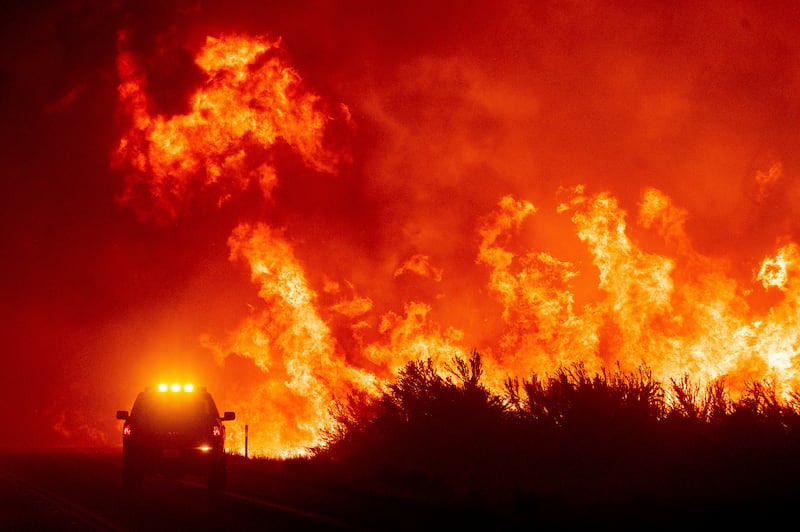
What wildfires are burning?
Significant wildfires have already taken hold in California and New Mexico, according to CNN. New Mexico’s fire season arrived “dangerously early,” according to The Associated Press.
- Fireweatheravalanche.org reports that New Mexico has seen more than 791,000 acres burn as the result of 72 fires.
- In 2021, the Dixie fire in California was the nation’s largest, with more than 960,000 acres burned. California was also hit by the Caldor fire, which burned more than 221,000 acres.