

- This episode of La Niña is later than expected, weaker than normal and is expected to end soon.
- The effects of La Niña have contributed to the dry weather in Southern California where wildfires are burning.
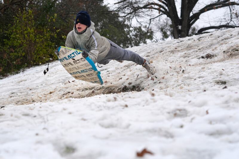
- Periods of cold arctic air have dominated La Niña in the Southern states causing winter storms.
It is just the start of 2025, but the U.S. is already seeing extreme weather across the country, from the wildfires raging in Southern California to the uncharacteristically heavy snow in the Southeast and it seems that the return of La Niña may be responsible for some of it.
The official return of the La Niña weather pattern was declared on Thursday. Even though the disrupting weather pattern is late and weaker than normal, it is still having an impact on winter weather which is seen in the rain in the Northwest and the droughts across the country, according to reports.
La Niña “is the inverse of the better-known El Niño and is known for cooling a vast swath of the Pacific Ocean. That tends to lower average global temperatures, while also encouraging weather extremes that include intense Atlantic hurricanes, East African drought and floods in Indonesia," per The Washington Post.
What are the effects of La Niña in the U.S.?
According to The Washington Post, La Niña is known for causing warm and dry winter weather across the southern tier of the U.S. and wet snowy conditions from the Pacific Northwest to the northern Plains.
La Niña is not responsible for the winter storm that hit multiple states in the South this week, but it is likely responsible for the drought which rapidly developed in the eastern part of the country toward the end of 2024.
The weather pattern commonly brings heavier precipitation to the Midwest, this has been seen as multiple major Midwest cities are experiencing a start to winter that is much wetter than usual, per CNN.
California is also affected by the emergence of the weather pattern. During a La Niña winter, there is typically wetter weather in Northern California and drier than normal conditions in the southern part of the state.
These dry conditions promoted by the weather pattern have helped fuel the wildfires that are engulfing the area around Los Angeles. According to CNN, La Niña also has contributed to the drought that all of Los Angeles County is currently experiencing.
Winter storms in the South prove La Niña isn’t the only factor at play
A La Niña winter, as Americans are experiencing this year, usually brings drier and warmer weather to the South, but due to other factors this is not the case this year, according to CNN.
The weather in the eastern part of the country has been dominated by periods of brutally cold arctic air causing the winter storms and disruptive weather that have been seen in the area since December.
A winter storm has dumped snow and other mixed precipitation across multiple states in the southern U.S. that are not accustomed to this type of weather, according to The Associated Press.
This powerful storm has brought heavy snow and icy conditions to Southern states such as Texas, Arkansas and Georgia, forcing school closures and states of emergencies to be declared.
Heavy snow fell in Texas and Oklahoma on Thursday and it moved east hitting other states such as Arkansas and Tennessee Friday morning.
Other states in the southeast have received a mix of sleet and icy rain, making roads treacherous, per the AP.
By Friday morning, over 2,600 flights in and out of U.S. had been canceled, and over 70,000 homes and businesses in Arkansas and Texas were without power, per CNN.
What is La Niña?
According to USA Today, “La Niña is a natural climate pattern marked by cooler-than-average seawater in the central and eastern Pacific Ocean. When the water cools at least 0.9 degree Fahrenheit below average for three straight months, a La Niña is declared."
Even though it sounds small, this change in temperature can make a significant impact in weather patterns around the globe.
La Niña is a part of the climate pattern referred to as the El Niño-Southern Oscillation, or ENSO, which shifts between three phases affecting global temperatures. The cycle is based on the temperature of the seawater in the equatorial Pacific, per CNN.
ENSO shifts between its three phases, El Niño, La Niña and neutral conditions, irregularly with each phase typically sticking around for one to two years.
El Niño is more well-known and is the opposite to La Niña, occurring when water temperatures in the Pacific are above average by at least 0.9 degree for three months, per USA Today.
Neutral conditions are declared when neither El Niño nor La Niña is present.
According to The Washington Post, these shifts are tracked as scientists monitor key zones in the central and eastern Pacific Ocean.
How is this La Niña different?
This episode of La Niña is different than usual in the time that it emerged, its strength and how long it will last.
According to The Washington Post, phases of ENSO typically last one to two years, but this particular episode of La Niña is expected to end in just a few months, sometime between March and May. Neutral conditions will take its place.
The last episode of La Niña endured for three years, ending in early 2023.
This episode came much later than expected. El Niño ended in June of 2024 and according to USA Today, it was expected that La Niña would arrive shortly after sometime during the summer or fall.
La Niña didn’t emerge until December, leaving a period of neutral conditions through the summer and fall. It is unclear why it took so long for the La Niña to develop, according to CNN.
The delay of the La Niña episode isn’t the only surprise with its emergence “It’s unusual for a La Niña to form at this time of year, instead of during the spring or summer. And it never developed the strength that had appeared likely months earlier,” per The Washington Post.
Both La Niña and El Niño have the greatest influence on weather during winter, meaning this current La Niña has lost time. It is starting right when it would normally be at peak strength and is already beginning to dwindle, according to CNN.
What will the rest of winter look like?
Despite a delayed and weaker La Niña episode the national forecast for the rest of the season aligns with the typical conditions brought by the weather pattern, per USA Today.
For the rest of winter, the southern part of the U.S. is expected to see conditions that are drier and warmer than usual.
The Northwest is forecasted to experience weather that is wetter and cooler than average, per CNN.