

- A massive cloud of dust from the Sahara Desert will reach the U.S. this week.
- The Sahara Air Layer occurs when dry air and dust gathers over the Sahara Desert.
- This is the largest dust event to travel across the Atlantic this year.
After making its way across the Atlantic Ocean, a massive cloud of dust from the Sahara Desert is expected to reach the U.S. on Wednesday afternoon.
The cloud of dust, which is believed to stretch 2,000 miles west to east and 750 miles from north to south, will first hit Florida and then spread to other states, according to USA Today. When it reaches Florida it will have traveled over 5,000 miles from North Africa.
This is the largest Saharan dust cloud so far this year to travel across the Atlantic.
It is expected to have little effect on air quality, as it will remain high in the atmosphere, but Floridians should see hazy skies or colorful sunrises and sunsets midweek.
“Typically we have nice blue skies, but with the dust, the whole sky looks soft and warm because the particles themselves are red,” said Joseph Prospero, professor emeritus at the University of Miami Center for Aerosol Science and Technology, according to The New York Times.
“Everything looks muted,” he added.
How does this Saharan dust cloud occur?
This dust is technically known as the Saharan Air Layer, or SAL, and is a relatively common feature, according to The Washington Post. It is more unusual to see the SAL stay so strong after journeying across the ocean.
The SAL is a very dry and dusty mass of air that forms above the Sahara Desert in late spring, summer and early fall, according to the Atlantic Oceanographic and Meteorological Laboratory. Every few days the dust clouds move over the Atlantic Ocean.
According to The New York Times, the dry layer of air that makes up the SAL hovers around a mile above the Earth’s surface and can be up to 2.5 miles deep.
The SAL is carried west by the same winds that kick up hurricane season. These dust events can happen year-round but the largest occur from mid-June to late July and after early August the plumes of dust tend not to travel as far.
Earlier this year a few smaller SALs crossed the ocean but this is the first significant plume of the year.
“It happens every year; some years have more dust transportation across the Atlantic than others,” said Sammy Hadi, a meteorologist at the National Weather Service office in Miami, per The New York Times.
“It’s like rinse and repeat every year, it’s part of a normal cycle of Earth’s oscillations.”
Since the SAL is brought on by the same winds that drive tropical disturbances, excessive levels of dust can suppress and stifle tropical storms. This happens because the dust clouds are so dry and tropical storms require moisture to grow, per The Washington Post.
The dust cloud is formed by light dry sands and other minerals, but they require a jet stream positioned correctly to send them westward. The SAL can also be shot northward toward Europe.
This particular cloud that will reach the U.S. stirred up over Africa near Chad in late May.
Meteorologists get plenty of notice for when an SAL is headed to the U.S., since the dust storms are visible by satellite developing over the Sahara seven to 10 days before reaching the Caribbean or the Gulf of Mexico, per The New York Times.
Where and when will the dust cloud hit the U.S.?
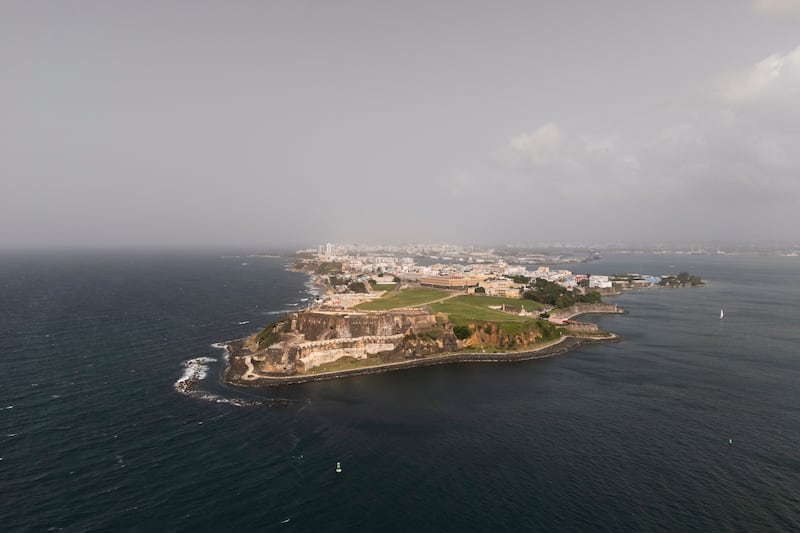
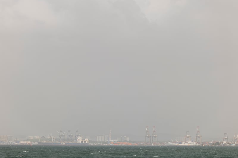
Earlier this week, the dust cloud covered the Caribbean islands on its way to the U.S. The cloud was dense and caused hazy skies in Puerto Rico, and early Wednesday morning the cloud was affecting Cuba, per USA Today.
The plume of dust should reach south Florida by Wednesday afternoon or evening, and then on Thursday it is expected to spread to the rest of Florida going north into parts of Georgia and South Carolina.
By the weekend, it is predicted to reach other Gulf Coast and Southeastern states such as Louisiana, Mississippi and Alabama, reported AccuWeather. It is then expected to dissipate.
Jason Dunion, a meteorologist who monitors Saharan dust and hurricanes, has been in Puerto Rico during a Saharan dust event before, per The New York Times.
“There’s a lot of dry air, and you don’t feel that dry air, but the clouds feel it because as they grow and form thunderstorms, they run into that dry air and they just collapse,” he said. “They get stifled. So as this comes through to a place like Puerto Rico, you’re going to tend to have fewer thunderstorms. It’s going to probably be one of our hotter days. And very hazy. The haze is incredible.”
The Saharan dust could collide with wildfire smoke
It is possible that the Saharan dust could collide with smoke which made its way to the U.S. from wildfires burning in Canada, per USA Today.
The smoke has caused unhealthy air quality in several states over the last week, including Minnesota and Wisconsin. It has also caused moderate air quality across most of the eastern half of the country.
Later in the week, there could be a small area where the smoke and dust come together over the southeast, per USA Today. It should not cause health or safety issues, except for sensitive groups.