

FARMINGTON — If you're brave enough to leave the paved, congested and standard highways of Davis County and hit the steep dirt and uncrowded roads in the mountains, a world of beauty and spectacular bird's-eye views await you.
Especially with the brilliant fall colors of the leaves coming this month, the "Skyline Drive" scenic byway is well worth a visit.
Trucks, four-wheel-drive vehicles or motorcycles are the preferred form of travel here, but even regular cars can make this trip on dry roads. Mountain bicycles, too, will work well here.
Probably only acrophobes need not consider traveling this dizzying road, which does have a few drop-offs. Climbing almost a vertical mile, the dirt road rises almost as high as the Francis Peak radar domes (9,515 feet above sea level) on the north section and to near Bountiful Peak (9,150 feet above sea level) on the south segment.
Distance wise, the road is about 24 miles long from Farmington to Bountiful. Add another 10 miles round-trip if you also travel north to Francis Peak.
However, the dusty road itself is not especially steep and climbs only about 400 feet per vertical mile.
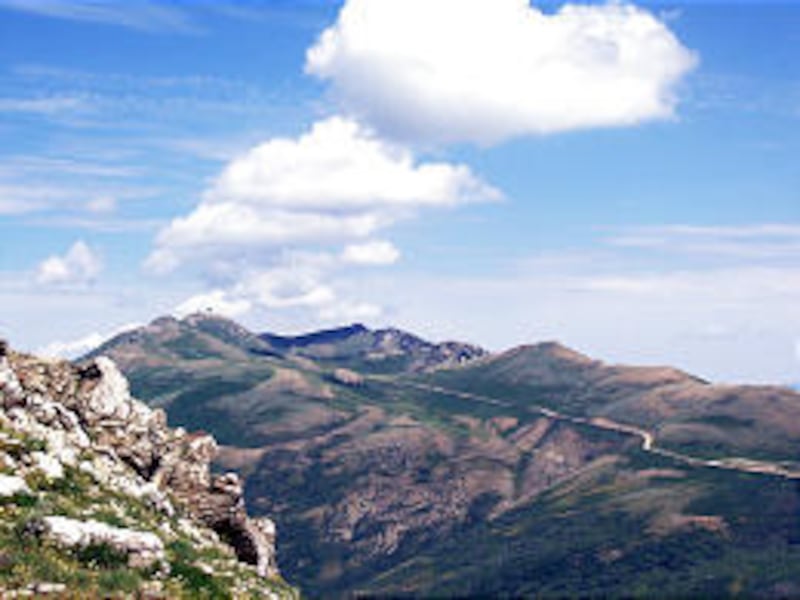
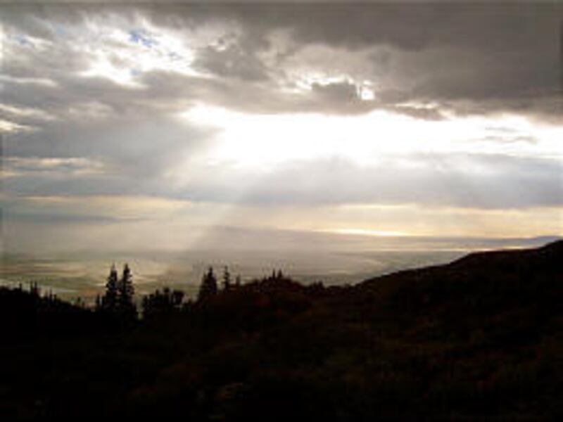
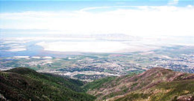
"The route is best known for its scenic views," says "Utah! Scenic Byways and Backways," published by the Utah Travel Council. "Vistas of the Great Salt Lake are stunning. From Francis and Bountiful peaks, the mountain ranges of the west desert are clearly defined. Vegetation is mostly scrub brush, but stands of pine and fir are sprinkled throughout the route."
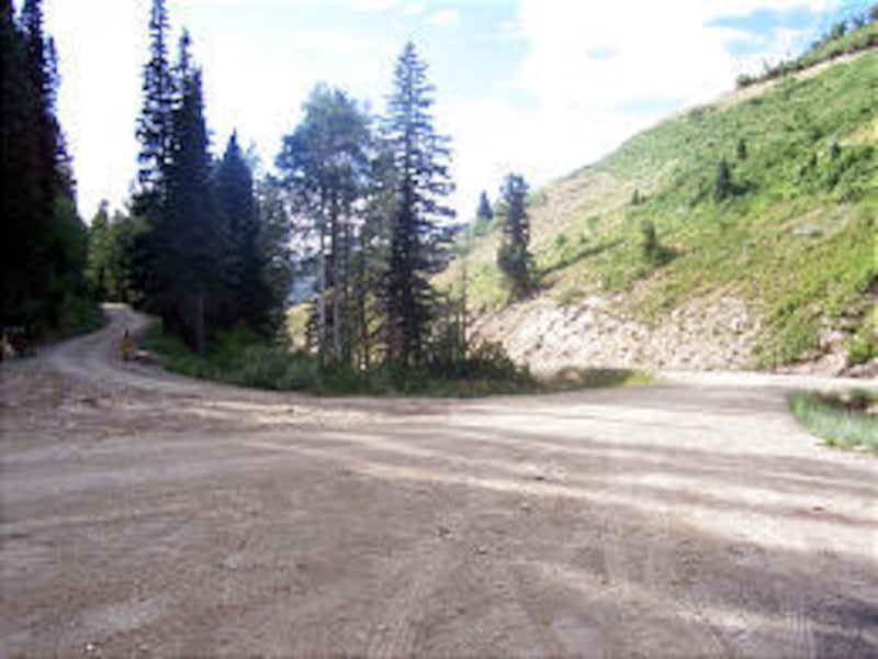
The Farmington Canyon drive is one of 58 "scenic backways" in Utah. It is technically composed of three Wasatch-Cache National Forest roads.
Visitors here often agree that the scenery and vistas are "out of this world."
Some hang-gliders have launched off the mountains from near Francis Peak and believe it's one of the highest spots in the nation to fly from, based on fairly easy accessibility.
Binoculars and cameras are excellent accessories to better enjoy the views and have keepsake images. Visitors also have to plan on much cooler temperatures on the mountain skyline than in the valley below.
Weekends and holidays are the most crowded times on the byway, but weekdays can offer plenty of solitude.
Motorists should not plan on rushing through this drive. Caution should also be exercised on any blind curves as passing distance in some sections of the road is very narrow,
There are also two campgrounds along this route. Sunset Campground is 5.2 miles up the road from Farmington. It has seasonal restrooms and water. The Bountiful Peak Campground (seven miles from Farmington) lacks such facilities.
The Farmington Canyon road was constructed in the 1930s as part of the Civilian Conservation Corps.
Oddly enough, some of the upper segments of the road are the widest and smoothest of the entire trip. So don't let a rugged first mile or two detour your plans. The first mile of the road from Farmington is paved to the first switchback, but then dirt road becomes the norm.
The key landmarks are the two futuristic-looking white domes of Francis Peak. This may be the last true outpost in the county.
The domes are an important component of the Federal Aviation Administration's long-range aircraft-control radar system. They provide a 200-mile radar radius for the Salt Lake City International Airport and have 500 million watts of power. The airport itself has a 60-mile approach radar, but the Francis Peak station — like several other Intermountain domes on mountains — keeps planes from colliding.
Directly east of the Kaysville I-15 exit, Francis Peak was once one of Davis County's most craggy mountain summits. However, some 22,000 cubic yards of material and 32 feet of the peak's height were removed to level the site for the radar domes in the late 1950s.
The FAA maintains the entire road to the site year-round with a giant rotary snowblower, grader and two Caterpillars. In winter, that's great for snowmobilers and winter campers. Otherwise, the public would likely be unable to travel up the canyon because of snow blockage — unless the Forest Service did the expensive maintenance work.
North of the radar domes, a jeep path and then a trail leads northward to Weber Canyon, passing by Thurston Peak, Davis County's tallest summit at 9,706 feet above sea level. It's a four-mile, one-way hike from Francis to Thurston, and it includes many ups and downs. (This is part of the Great Western Trail.)
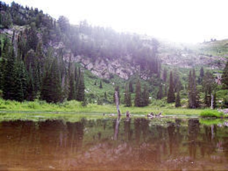
On the east side of the Wasatch and north of the radar domes are the Smith Creek Lakes. These are three ponds, some of which may support fish.
Allow at least 2 1/2 hours for the 24-mile drive and add another hour for the addition of the Francis Peak segment. The road is closed at times each winter, and cars cannot safely travel the road in winter or very wet weather. Mudslides, a seasonal problem after fires in the canyon, can also restrict travel. Access to Francis Peaks is also sometimes closed for road work or snow removal.
Late May to early October is the general season of open road use for this drive. However, following some snowy winters, snow persists until August in the road's upper reaches. Fifteen-foot-high walls of snow line the road south of the radar domes into late summer.
The Bountiful end of the road is usually open partway by each Memorial Day, but the upper road may not clear until early summer.
The route begins in Farmington on 100 East by going north. From Bountiful, head for the "B" on the mountainside and travel east on 400 North to 1300 East and then go north into Ward Canyon Road.
There are gates near the road's starting point and at the top of Farmington Canyon (6.5 miles up), where the road splits into the Francis Peak or the Bountiful Peak segments.
The Bountiful Peak Campground is a half-mile up from the gate at the junction, while Bountiful Peak is four miles distant.
There are some summer homes in the area above the Bountiful Peak Campground, and Farmington Pond is also in this area.
E-mail: lynn@desnews.com