

Rising as much as a mile above the valley floor, the Wasatch Mountains — the area's most dominant landmarks — clearly define the eastern boundary of Davis County. A physical feature that many take for granted, these mountains create a watershed that helps support life in Davis' 15 cities.
But what are the tallest peaks in these mountains? Where did their names originate?
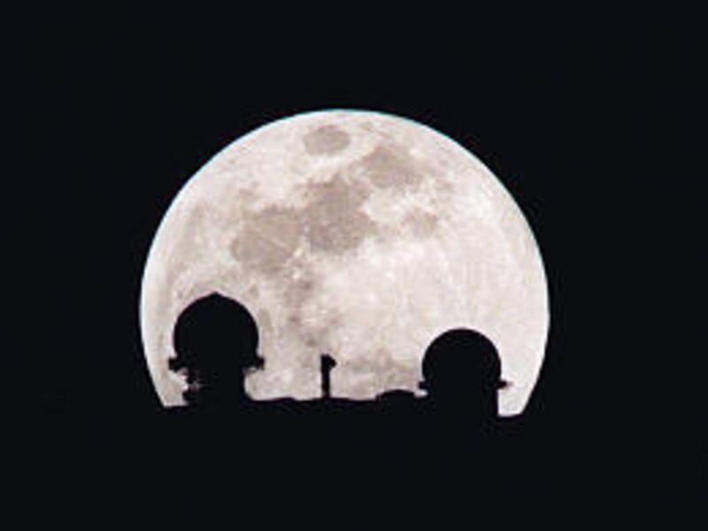
If one were to ask county residents to name the imposing peaks overlooking the housing-dominated flatlands nestled between the shores of the Great Salt Lake and the mountain foothills, its likely that the only answer that would be forthcoming is Francis Peak, which features a couple prominent white radar domes.
However, it's hard to really criticize the general ignorance concerning the names of the mountain peaks. That's because only two of the 10 highest peaks in the county (all located between Farmington Canyon in the center of the county and the mouth of Weber Canyon at the county's northern extremity) have been given official names by the Utah Geographic Names Committee, the state agency commissioned to identify the state's geological locales. While many have local nicknames that have historical roots, those names are not generally known outside the neighborhoods nearest to the peaks.
Only Francis Peak (9,515-foot natural elevation) and Thurston Peak, county's tallest (9,706), have official titles.
The number of peaks that have official names from Farmington southward to the Salt Lake County line isn't any higher either. Only Bountiful Peak (9,259-foot elevation) and Cave Peak (6,803) show up on USGS maps.
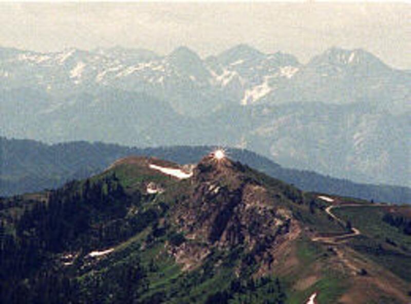
Francis Peak, Davis' most famous summit, was once Davis County's craggiest mountain, too. However, some 22,000 cubic yards of material and 32 feet of the peak's height were removed to level the site for the radar domes in the late 1950s.
The Federal Aviation Administration originally wanted to locate the radar site above Salt Lake City, near Alta or Snowbird. But the National Guard was already using a temporary facility at Francis Peak, so that became the joint location.
Workers at the peak's construction site had to wear thick, long boots and carry sticks or pistols. Although snake experts said the reptiles can't live that high, someone forgot to tell the rattlers.
There were numerous nests of rattlesnakes uncovered in the building process, despite the site's almost 2-mile-high elevation.
In the late 1970s, a tramway was proposed as a quicker and more convenient access up Shepard Canyon to Francis Peak. However, the FAA's approval for the site got caught in environmental red tape and never became a reality.
Francis Peak is named for Esther Francis, a pioneer woman who settled Morgan during 1863. She surveyed the site for Morgan city, and Brigham Young suggested she be honored by naming a high peak for her.
The peak, located directly east of the Kaysville I-15 exit, is a popular summertime scenic backway destination in Davis County, offering access to the Sunset and Bountiful Peak campgrounds as well as the most spectacular bird's-eye views possible of the Great Salt Lake.
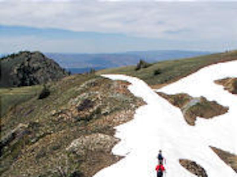
The road to the lofty radar domes that top the peak is officially known as Skyline Drive. It begins on Farmington's 100 East. It is paved for the first mile and then follows a winding, narrow dirt road for another 12 miles. Most cars can make this bumpy journey, though it is a backcountry road.
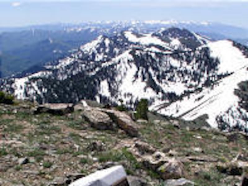
There's a fork in the road at the top of the canyon, about eight miles up. The right (south road) leads to Bountiful Peak and eventually Bountiful's east bench, some 19 miles later.
The left road (north) heads to the radar domes operated by the Federation Aviation Administration and Air National Guard. A gate on the left fork is closed during snow season because of dangerous snow removal equipment. But this time of year it's almost always open.
Snow banks along the upper reaches of the road — 9,000-foot plus elevation — continue until mid- to late July. On a clear day, even the High Uintas are visible to the east.
A popular hike goes along a jeep trail northeast of the radar towers to the Smith Creek Lakes.
While most maps list Francis Peak's elevation at 9,547 feet, that was its original height and doesn't account for the loss in height during the $2 million construction in 1958-59.
The natural height is now 9,515 feet, making it the fifth-highest peak in the county. The facility's base adds 55 feet and the radar domes chip in another 60 feet for a total of 115 feet in artificial height — making the peak, some could argue, 9,630 feet above sea level.
Davis County's highest summit didn't even receive an official name until 13 years ago. It was previously simply listed on maps as a bench mark of note.
A permanent monument of Utah granite was erected on Thurston Peak in 1993 with a brass plaque, encased in concrete, that reads:
"Named in honor of Thomas Jefferson Thurston, a Centerville resident who viewed the virgin valley of Morgan from the summit of the mountain in 1852 and recognized its potential for colonization. Realizing its disadvantage was its inaccessibility, in 1855 Thurston influenced others to assist him to carve a passable wagon road through Weber Canyon. He was among the first to settle in Morgan Valley and is acknowledged for bringing about its colonization."
That dedication culminated a five-month effort by the Morgan Historical Society to name the peak. The mountain is the tallest Wasatch range peak between Willard Peak on the Weber-Box Elder county line and Big Cottonwood Canyon in Salt Lake County.
(Thurston straddles the Davis-Morgan county line and as such can be claimed by both counties.)
Bountiful Peak is, of course, named for what was the county's first settlement. However, it's somewhat of a mystery why this peak was given its name when Bountiful city is almost six miles to the south. The peak is located east of Farmington's Glover Lane and Centerville is the next southward city, before Bountiful.
Some longtime north Davis residents have given some mountain formations to the east their own unofficial monikers.
For example, there's "Haystack" peak: An east Layton name for a bump, about 7,000 feet above sea level and halfway up the mountain, that resembles a stack of hay.
Above Kaysville, "Ed's Peak" is a 9,381-foot summit unofficially named for Ed Ford. He built a two-story log cabin below the mountain in Simmons Hollow, north of the cemetery, from timber obtained near the peak and sold in 1850 to John Green. Ford apparently moved to southern Utah. Ed's Peak is the tall summit between Baer and Webb canyons.
Canyons are another matter. All in Davis County canyons have official names. These range from Corbett Canyon, above South Weber on the county's north end to Hooper Canyon, above Val Verda, on the county's south side.
Davis County's 10 highest peaks
Davis County's 10 highest peaks (in descending order), all found from Fruit Heights northward:
1. Thurston Peak, 9,906. Located east of Layton's Cherry Lane.
2. and 3. (tie) Two unnamed, 9,571-foot summits. One is just north of Thurston Peak. The other is one peak north of that location.
4. A 9,536-foot unnamed summit, north of the twin 9,571-foot peaks.
5. Francis Peak, 9,515, located east of Kaysville and Fruit Heights, with the radar domes on top.
6. Nameless 9,491-foot peak, located between Webb and Adams canyons.
7, A 9,423-foot unnamed peak, just north of the peak identified above.
8. A 9,381-foot peak, near Webb Canyon and sometimes referred to by locals as Ed's Peak.
9. Nameless 9,365-foot peak, located between Francis Peak and the Smith Creek Lakes.
10. A 9,314-foot summit with no name, found just north of Francis Peak.
E-mail: lynn@desnews.com