
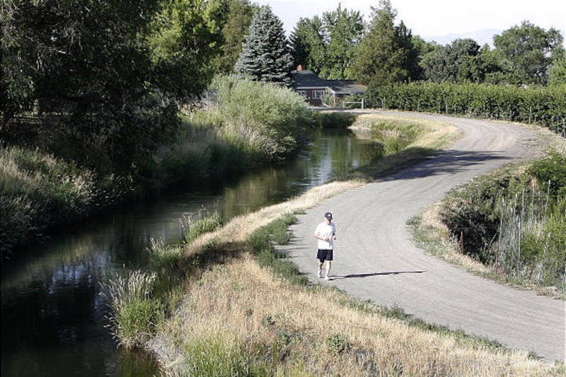
LINDON, Utah County — Few people pay attention to the "No Trespassing" sign that warns people off the maintenance road along the Murdock Canal.
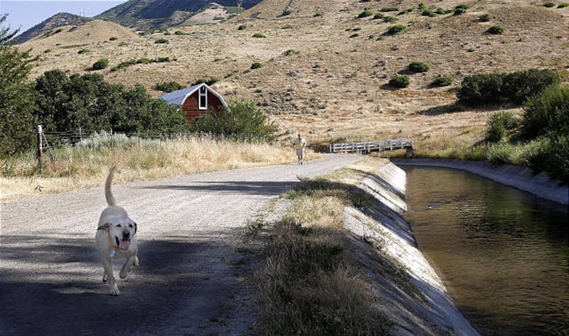
Every day, walkers, runners and cyclists can be found using the dirt road, and no one stops them.
"I walk that trail in the mornings," said Lindon Mayor Jim Dain, who lives near the canal. "There are a lot of folks that walk that trail in the morning, and they are not criminals."
Over the next few years, the canal will be transformed into a 10.5-foot-diameter underground pipe and 16 miles of urban trail — the longest in Utah County.
If comments at a series of public meetings to explain the project to local residents are any indication, the plan is a hit with most, including those who live with the canal in their backyard.
"I've been hoping for this ever since we moved in," said Diane Berrett, who moved into her Lindon home 20 years ago. "I think it will be good for the community."
The 21-mile canal was built in 1911 to carry water from the Provo River to irrigators and municipalities in Salt Lake County. It was enlarged in the 1940s. Officially, it is named the Provo Reservoir Canal, but for people living nearby, it's always been known as the Murdock Canal, and its history is checkered.
Over the years, the canal has been the site of multiple drowning deaths, usually the result of bizarre accidents, like the paraglider who landed in the canal in 1999 and was pulled into a syphon by his waterlogged parachute, or the two brothers who died in 2003 while trying to negotiate one of the canal's syphon tubes in scuba gear.
People who live near the canal tend to treat it with respect.
Preston Black, of Pleasant Grove, said his family uses the trail, but "it's off limits to our kids unless we are with them."
There are other issues. Where the canal runs along the hillsides of Lindon and Pleasant Grove, flooding is a constant concern, even though only one major break has been recorded recently.
In 1988, rodent holes and high water collapsed the canal bank in Lindon, causing hundreds of thousands of dollars in damage to homes flooded with water and mud before the canal was shut down.
Other people, such as Eldon Greenwood, report periodic episodes of basement flooding or other water issues. However, Greenwood said representatives of the Provo River Water Users Association, which manages the canal for the Bureau of Reclamation, told him high ground water, not the canal, was responsible for the flooding.
"We haven't had it every year," he said, "but the problem clears up when the canal dries up."
The $150 million construction project, which is set to begin in October and run two to three years, is meant to resolve those issues and save up to 8,000 acre feet of water a year now lost to seepage and evaporation. The subsequent $17 million trail project will provide an urban trail with paths for walkers and cyclists, as well as for equestrians.
Provo River Water Users Association officials are calling that a win-win-win scenario, and most of the 50-plus people who attended the second of three information meetings, held Wednesday in Pleasant Grove, seemed satisfied with the answers to most of their questions.
And while most of the money is going into covering the canal, it's the trail that generated most of the questions.
Will the trail be tree-lined? No, since roots and pipes don't make good neighbors.
Will there be restrooms along the trail? Yes, about every three miles at local trail heads, with sewer hookups, running water and drinking fountains.
Will anyone clean up after the horses on the equestrian trail? Mother Nature, but it would take a lot of horses to create a problem, since the right of way is about 100 feet wide, and the paved walking trail will only use 15 feet of that.
Dain, whose home was damaged by the 1988 break, said he has been working to get the canal covered for more than 15 years, and he's happy to see it finally happen.
"From my perspective, we are delighted," he said.
Neighbors along the canal echoed that support, for the most part, though Black said he would prefer that none of his taxes go to build or maintain the trail, and he's concerned about increased traffic.
"If they do it right so they are far enough away from my property, it will probably be OK," he said.
The trail will run through Orem, Lindon, Pleasant Grove, Cedar Hills, American Fork, Highland and Lehi. It will start at 800 North in Orem and end at state Route 72 near Lehi. The canal project will start at the mouth of Provo Canyon and end at Point of the Mountain, on the west side of I-15.
One final information meeting is planned for 6 p.m. Wednesday, July 28, in the Lehi Senior Center, 123 N. Center, Lehi.
e-mail: mhaddock@desnews.com