
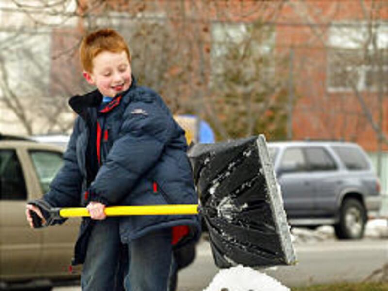

Hopes are fading for that heavy winter snowpack Utah needs to pull out of the five-year drought.
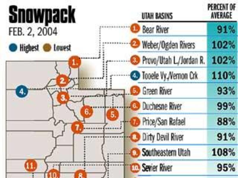
At this time a month ago, blizzards had walloped the state. Near Tooele, the snowpack reached 198 percent of normal for that time of year. It was about 135 percent in critical mountains above the Wasatch Front.
But for most of the weeks since, northern Utah remained locked in a deep-freeze temperature inversion that kept snow away. As of February's start, snow accumulations have dropped to 110 percent above Tooele and barely above normal in watersheds feeding into the most populous part of the state.
Normal isn't good enough to decisively end five years of drought. And chances are, the first half of February will be dry too, further dimming prospects.
Long-range weather algorithms show that through about Feb. 15, little precipitation will fall in the Beehive State. "The day-by-day computer charts . . . look, in my opinion, very pessimistic," said Mark Eubank, chief meteorologist for KSL.
A couple of storms may drift through, but they are not expected to be large or prolonged.
"The first half of the month ought to be drier than normal and colder than normal," Eubank said. Likely the whole month of February will turn out to be below average.
"We're just not getting the storms we need," agreed Randy Julander, snow survey supervisor for the Utah office of the U.S. Natural Resources Conservation Service.
Northern Utah's snow water content has dropped from about 120 percent or 140 percent of average to between 90 percent and 100 percent, he said.
"It's not that the snow melted. It's just that we didn't get any additional snow. And normally January tends to be a very snowy month."
In order to maintain that phenomenal snowpack, Utah would have needed at least a normal January, and it didn't get one.
"We just didn't pick up any snow," after the first week. "It's been pretty doggone dry."
Julander added that the good news is the Utah snowpack hovers near average. "Even better news is, we're still almost double what we were last year."
Two storms a week would be required for the rest of the winter in order to get back that much-above-usual snowpack. "We need to make up two great big holes," Julander added.
Reservoir storage is very low, he said, and soil in the mountain regions is dry. Before the spring runoff can reach the reservoirs, much of it will be soaked up by the thirsty ground.
Most of Utah is about average for the snowpack, but the Escalante River basin is "absolutely horrible," and the Virgin River region is "barely scraping along." The Escalante is pegged at 67 percent of normal snowpack and the Virgin, 81 percent.
"Even the folks down there on the Escalante and Virgin have something to smile about because they've got twice the snow this year that they had last year," Julander said.
The long-range patterns are classified "EC" for "equal chances" for average, below average or above average precipitation. But Julander has another term for the initials: "essentially clueless."
Eubank holds onto hope the weather will turn around: "In my gut, I think the spring will be wet."
E-mail: bau@desnews.com