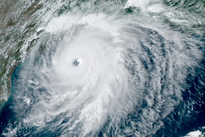
The National Oceanic and Atmospheric Administration shared a video on Wednesday that showed Hurricane Laura was full of lightning as it drew near to the Louisiana coast.
- Hurricane Laura hit Louisiana overnight as a Category 4 hurricane (and had neared Category 5 status before that), as I wrote for Deseret.com. Once it made landfall, the hurricane became a Category 2 and has already brought widespread damage to Lake Charles and surrounding areas.
The NOAA’s satellite footage shows the storm approaching Louisiana with bolts of lightning flashing.
Bigger picture:
Many worried the storm surge from the hurricane would bring the most damage and severe conditions.
Louisiana Gov. John Bel Edwards said on “Your World” Wednesday evening: “The storm surge is going to be a huge threat to life. And, in fact, the National Weather Service took the unprecedented step of saying the storm surge is going to be unsurvivable.”
- Edwards said in a briefing: “This is a very serious storm. In the five years I’ve been governor, I don’t believe I’ve had a press conference where it was my intention to convey the sense of urgency that I am trying to convey right now. Our state hasn’t seen a storm surge like this in many many decades.”
The National Hurricane Center said: “The eyewall of Laura is moving onshore over southwestern Louisiana. TAKE COVER NOW! Treat these imminent extreme winds as if a tornado was approaching and move immediately to the safe room in your shelter. Take action now to protect your life.”


