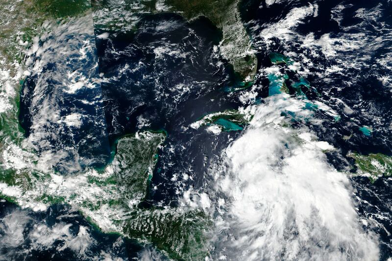
High winds, massive waves, flooding and even tornadoes are among the predictions as Hurricane Ian moves toward Florida, where it’s predicted to reach the Florida Keys Tuesday afternoon, before making landfall somewhere between Tampa and Naples Wednesday night into Thursday morning.
ABC News reported that 2.5 million Floridians are under evacuation orders. Gov. Ron DeSantis said Tuesday that storm surge and “catastrophic” flooding are the biggest worries.
The path has slightly altered from the predicted direct hit on Tampa Bay, though the area is expected to be heavily impacted. Tampa Bay has not taken a direct hit from a major hurricane in more than a century.
Officials warn that this hurricane still has potential to change direction and some models show it cutting across the state to the east. So the entire state is bracing for the arrival of Ian, which hit Cuba early Tuesday as a Category 3 hurricane with sustained winds of up to 125 mph and extremely dangerous storm surge, according to the National Hurricane Center.
The Hurricane Ian tracker shows Ian making an unusual journey up the west coast of the Florida panhandle, rather than skirting along the east coast, which is far more typical. But the hurricane’s power and reach is such that most of the state is expected to be dumped on with at least a heavy tropical storm, according to CNN meteorologists. As of Tuesday morning, it was traveling north at 10 mph.
In Cuba, Ian made landfall as a Category 3 hurricane just southwest of La Coloma in western Cuba about 4:30 a.m. with sustained 125 mph winds, the National Hurricane Center said. Its hurricane-force winds stretched out 35 miles with tropical-force winds reaching 140 miles from Ian’s center.
By Tuesday afternoon, Ian is expected to be a Category 4 hurricane with 140 mph winds and gusts up to 165 mph in the Gulf of Mexico, “before turning, slowing down its forward speed and making a beeline to Florida’s Gulf Coast,” according to the Orlando Sentinel.
Evacuation orders could be expanded as Ian nears, according to The New York Times. Right now, coastal sections of Hillsborough County, which includes Tampa, are under mandatory evacuation orders, with voluntary evacuations recommended further from the coast. Other counties with both mandatory and voluntary evacuations include Pasco, Pinellas, Manatee, Sarasota Charlotte and Lee counties.
Meanwhile, tornado watches have been issued in Miami, Fort Lauderdale, Palm Beach, Naples and Key West until early evening.
While the east coast of Florida has a storm surge warning, the hurricane watch on the west Florida coast stretches from south of Bonita Beach to Chokoloskee. While a tropical storm warning sounds pretty benign compared to a hurricane, it still denotes potential danger, according to the National Hurricane Center advisory, with “danger of life-threatening inundation from rising water moving inland from the coastline.”
The hurricane’s slow speed could promise punishing rainfall, with predictions exceeding 15 inches from Tampa to Orlando, per ABC News. And Orlando, Tampa and St. Petersburg have been warned that major flooding is possible.
Weather.com Tuesday morning shows a jammed I-4 corridor as Tampa residents try to drive away from Ian’s path.
DeSantis said at a press conference that 5,000 members of the National Guard from Florida and 2,000 from nearby states have been activated, and five urban search and rescue teams are ready to go to work, the Sentinel reported.
The Federal Emergency Management Agency tweeted advice for those who might be in Ian’s path who have mobility or medical needs. It warned vulnerable residents to plan how they will evacuate if it’s needed, including accessible transportation. They were also told to add their medical information to their electronic devices and to ask neighbors to help gather supplies and check on them.


