
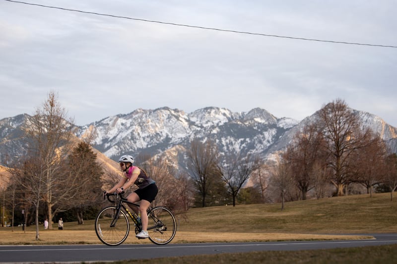
Utah might be in astronomical winter and meteorological spring, but a projected warm wave headed its way could bring temperatures more reminiscent of early summer.
A high-pressure system beginning to build up off the California coast is projected to produce record warmth all across the West next week, including Utah. That, in turn, might impact its already poor snowpack and put this year’s collection in the record-low category.
“We’re basically going to be experiencing early summer temperatures in March,” said KSL meteorologist Matt Johnson.
However, a small storm will cool down temperatures in some parts of the state this weekend before that.
Small storm to impact northern Utah
A shallow cold front wrapping around the growing Western high-pressure system is forecast to zip through northern Utah Saturday evening, potentially providing some valley showers in northern Utah and the Wasatch Front, Johnson said.
“It’ll bring a chance for some showers Saturday evening, but it’s a quick-mover and it should be out of here by Sunday,” he said.
Some communities in the region may only receive a trace of precipitation by early Sunday, while others could gain a quarter of an inch or more, according to KSL Weather models.
Its bigger impact will be wind and cooler temperatures. The National Weather Service issued a series of high wind warnings, watches and advisories for most of northern and central Utah, which could experience wind gusts of 50 mph or greater between Saturday afternoon and early Sunday. Higher gusts are possible in the mountains and areas affected by downsloping winds.
High temperatures are forecast to drop from the upper 60s and low 70s on Friday to the 50s and 60s on Saturday and then the upper 40s on Sunday. Overnight lows may drop to below-freezing levels across many parts of Utah’s northern half.
Some parts of southern Utah, especially its eastern edge, could see temperatures drop into the low 50s. However, St. George, which won’t be impacted much by the weekend cooldown, is forecast to have temperatures remain in the 70s.
Summer in March?
Those cool temperatures likely won’t last long, though.
Temperatures across the state are forecast to jump 20 to 30 degrees above normal across the state. Many of the forecasted highs are normal for early June at the start of meteorological summer, the National Weather Service points out.
High temperatures along Utah’s northern half are currently forecast to jump back to the upper 50s and low 60s by Monday, before jumping into the 70s and potentially 80s later in the week. Salt Lake City’s all-time highest March temperature is 80 degrees, set on March 31, 2012, which remains the earliest 80-degree day since the weather service began tracking its weather in 1874.
High temperatures could even reach the 70s in Park City and the 60s in Alta, among higher-elevation communities in the state. St. George will likely post its earliest 90-degree day on record by midweek, too, while some other parts of the West could even hit triple-digits, Johnson said.
“It would even be an impressive high-pressure system for summer standards — that’s how amplified it is,” he said.
Bad news for snowpack
Federal forecasters warn that an “early onset of high-elevation snowmelt” is possible with the warm wave. That’s bad news for what has already been a rough year for winter recreation enthusiasts and water managers.
Cherry Peak has already called it a season, but other Utah resorts may have to close earlier than usual, depending on what happens in the coming weeks, Johnson adds.
Utah’s statewide snowpack has already fallen back down since reaching as high as 8.4 inches of snow water equivalent earlier this month, according to the Utah Natural Resources Conservation Service. At 8 inches, as of Friday, it would need to gain, on average, 2.2 inches over the rest of the season just to match its all-time low set during the 2014-15 winter — or more depending on any potential snowmelt.
Jordan Clayton, a hydrologist for the agency, estimates that Utah had about a 30% chance of setting a record-low snowpack total this year, as he did in February. Should the forecast come to fruition, he said those odds could jump up to as high as 50%.
Actual snowmelt from the warm wave and other variables, including any future storms after it, would likely factor into the state’s odds this year.
About 95% of the state’s water comes from snowpack. Salt Lake City is mulling a return to its drought contingency plan based on the poor snowpack and water outlook, which could be made worse with an early snowmelt. Others will likely follow suit, Mayor Erin Mendenhall said this week.
“I expect that, in the coming weeks, you’ll be hearing from state, county and local governments about the needs associated with this very dry winter that we’ve had,” she said.